Your web browser is no longer supported. To improve your experience update it here
Australian weather forecast
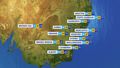
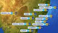
National weather
Rain Radar map
09:10 AEST09:15 AEST09:20 AEST09:25 AEST09:30 AEST09:35 AEST09:40 AEST


Weather Satellite
08:30 AEST08:40 AEST08:50 AEST09:00 AEST09:10 AEST09:20 AEST09:30 AEST


Synoptic weather chart
View national synoptic
Monday 01:04 EST
Low pressure over the Tasman Sea will bring showers and storms to eastern NSW, Tas and east Vic. Moisture laden winds over the northern tropics will bring heavy showers and storms to the northern NT & far north Qld. Onshore winds bring showers to the south coast of SA & WA.
Issued Sunday 04:04 EST
Weather warnings
Initial Minor Flood Warning For The Tuggerah Lake
Australian Government Bureau of Meteorology, New South Wales Initial Minor Flood Warning For The Tuggerah Lake Issued at 09:34 AM EST on Monday 28 April 2025 Flood Warning Number: 1 MINOR FLOODING POSSIBLE AT LONG JETTY MONDAY AFTERNOON Moderate to heavy rainfall has been observed in the Tuggerah Lake Catchment during Sunday, causing river level rises across the catchment. No significant further rainfall is forecast. River levels may reach the minor flood level along Tuggerah Lake at Long Jetty Monday afternoon, as upstream flows arrive. Tuggerah Lake: Minor flooding may occur along the Tuggerah Lake. The Tuggerah Lake at Long Jetty is currently at 0.80 metres and steady, below the minor flood level (0.90 m). The Tuggerah Lake at Long Jetty may reach the minor flood level (0.90 m) Monday afternoon. Flood Safety Advice: In life threatening emergencies, call 000 (triple zero) immediately. If you require rescue, assistance to evacuate or other emergency help, ring NSW SES on 132 500. * Avoid drowning. Stay out of rising water, seek refuge in the highest available place. * Prevent damage to your vehicle. Move it under cover, away from areas likely to flood. * Avoid being swept away. Stay out of fast-flowing creeks and storm drains. * Never drive, ride or walk through flood water. Flood water can be deceptive and dangerous.} For more emergency information, advice, and access to the latest river heights and rainfall observations and forecasts: * NSW SES: www.ses.nsw.gov.au * RMS Live Traffic: www.livetraffic.com * Latest River Heights and Rainfall Observations: http://www.bom.gov.au/nsw/flood/greatersydney.shtml * Latest NSW Warnings: www.bom.gov.au/nsw/warnings/ * Rainfall Forecasts: www.bom.gov.au/australia/meteye/ * BOM NSW Twitter: www.twitter.com/BOM_NSW Next issue: The next warning will be issued by 10:00 am EST on Tuesday 29 April 2025. Latest River Heights: Jilliby Creek at Jilliby,2.15,Rising,09:15 AM MON 28/04/25 Tuggerah Lake at Long Jetty,0.80,Steady,09:15 AM MON 28/04/25 Tuggerah Lake at The Entrance,0.80,Steady,09:15 AM MON 28/04/25 This advice is also available by dialling 1300 659 210. Warning, rainfall and river information are available at www.bom.gov.au/nsw/flood. The latest weather forecast is available at www.bom.gov.au/nsw/forecasts.Final Flood Warning For The Nambucca River
Australian Government Bureau of Meteorology, New South Wales Final Flood Warning For The Nambucca River Issued at 09:25 AM EST on Monday 28 April 2025 Flood Warning Number: 5 FLOODING NO LONGER OCCURRING AT BOWRAVILLE AND NO LONGER EXPECTED AT MACKSVILLE No significant rainfall has been recorded in 24 hours to 9:00 am Monday. No significant rainfall is forecast for the next few days. Flooding is no longer occurring along the Nambucca River at Bowraville and no longer expected at Macksville. Nambucca River: Flooding is no longer occurring along the Nambucca River at Bowraville and not expected at Macksville. The Nambucca River at Bowraville (Lanes Bridge) is currently at 3.38 metres and falling, below the minor flood level (5.50 m). The Nambucca River at Bowraville (Lanes Bridge) is expected to remain below the minor flood level. The Nambucca River at Macksville - Princess Street is currently at 0.98 metres and rising, below the minor flood level (1.70 m). The Nambucca River at Macksville - Princess Street is expected to remain below the minor flood level. Flood Safety Advice: In life threatening emergencies, call 000 (triple zero) immediately. If you require rescue, assistance to evacuate or other emergency help, ring NSW SES on 132 500. * Avoid drowning. Stay out of rising water, seek refuge in the highest available place. * Prevent damage to your vehicle. Move it under cover, away from areas likely to flood. * Avoid being swept away. Stay out of fast-flowing creeks and storm drains. * Never drive, ride or walk through flood water. Flood water can be deceptive and dangerous.} For more emergency information, advice, and access to the latest river heights and rainfall observations and forecasts: * NSW SES: www.ses.nsw.gov.au * RMS Live Traffic: www.livetraffic.com * Latest River Heights and Rainfall Observations: www.bom.gov.au/nsw/flood/midnorth.shtml * Latest NSW Warnings: www.bom.gov.au/nsw/warnings/ * Rainfall Forecasts: www.bom.gov.au/australia/meteye/ * BOM NSW Twitter: www.twitter.com/BOM_NSW Next issue: This is a final warning, no further warnings will be issued for this event. Latest River Heights: Nambucca River at Bowraville Upstream,2.06,Falling,09:00 AM MON 28/04/25 Nambucca River at Bowraville (Lanes Bridge),3.38,Falling,09:08 AM MON 28/04/25 Taylors Arm at Utungun,1.27,Steady,09:00 AM MON 28/04/25 Nambucca River at Macksville-Princess Street,0.98,Rising,09:00 AM MON 28/04/25 This advice is also available by dialling 1300 659 210. Warning, rainfall and river information are available at www.bom.gov.au/nsw/flood. The latest weather forecast is available at www.bom.gov.au/nsw/forecasts.Final Flood Warning For The Bellinger River
Australian Government Bureau of Meteorology, New South Wales Final Flood Warning For The Bellinger River Issued at 09:05 AM EST on Monday 28 April 2025 Flood Warning Number: 4 FLOODING NO LONGER EXPECTED AT THORA AND BELLINGEN No significant rainfall has been recorded in 24 hours to 9:00 am Monday. No significant rainfall is forecast for the next few days. Flooding is no longer expected along the Bellinger River at Thora and Bellingen. Bellinger River: Flooding is no longer expected along the Bellinger River. The Bellinger River at Thora is currently at 2.53 metres and falling, below the minor flood level (3.00 m). The Bellinger River at Thora is expected to remain below the minor flood level. The Bellinger River at Bellingen is currently at 1.73 metres and falling, below the minor flood level (3.70 m). The Bellinger River at Bellingen is expected to remain below the minor flood level. Flood Safety Advice: In life threatening emergencies, call 000 (triple zero) immediately. If you require rescue, assistance to evacuate or other emergency help, ring NSW SES on 132 500. Avoid drowning. Stay out of rising water, seek refuge in the highest available place. Prevent damage to your vehicle. Move it under cover, away from areas likely to flood. Avoid being swept away. Stay out of fast-flowing creeks and storm drains. Never drive, ride or walk through flood water. Flood water can be deceptive and dangerous} For more emergency information, advice, and access to the latest river heights and rainfall observations and forecasts: * NSW SES: www.ses.nsw.gov.au * RMS Live Traffic: www.livetraffic.com * Latest River Heights and Rainfall Observations: www.bom.gov.au/nsw/flood/midnorth.shtml * Latest NSW Warnings: www.bom.gov.au/nsw/warnings/ * Rainfall Forecasts: www.bom.gov.au/australia/meteye/ * BOM NSW Twitter: www.twitter.com/BOM_NSW Next issue: This is a final warning, no further warnings will be issued for this event. Latest River Heights: Bellinger River at Thora,2.53,Falling,09:02 AM MON 28/04/25 Never Never Creek at Gleniffer,1.27,Falling,07:41 AM MON 28/04/25 Bellinger River at Bellingen,1.73,Falling,08:58 AM MON 28/04/25 Bellinger River at Repton,0.93,Rising,08:45 AM MON 28/04/25 Kalang River at Kooroowi-Scotchman,1.57,Steady,08:55 AM MON 28/04/25 Kalang River at Newry Island (AHD),0.94,Rising,08:45 AM MON 28/04/25 Kalang River at Urunga (AHD),0.90,Rising,08:45 AM MON 28/04/25 This advice is also available by dialling 1300 659 210. Warning, rainfall and river information are available at www.bom.gov.au/nsw/flood. The latest weather forecast is available at www.bom.gov.au/nsw/forecasts.Minor To Moderate Flood Warning For The Williams River
Australian Government Bureau of Meteorology, New South Wales Minor To Moderate Flood Warning For The Williams River Issued at 06:20 AM EST on Monday 28 April 2025 Flood Warning Number: 4 MODERATE FLOODING EXPECTED AT MILL DAM FALLS EARLY MONDAY MORNING MINOR FLOODING OCCURRING AT DUNGOG Heavy rainfall during Saturday and Sunday has caused river level rises along the Williams River. Minor flooding is occurring at Dungog. At Mill Dam Falls, minor flooding is occurring and moderate flooding is expected from early Monday morning. No significant rainfall is expected across the Williams River catchment during Monday. The situation is being closely monitored and this warning will be updated as required. Williams River: Moderate flooding is expected along the Williams River. The Williams River at Dungog peaked at 6.69 metres around 11:00 pm Sunday 27 April and is currently at 5.56 metres and falling, above the minor flood level (4.90 m). The Williams River at Dungog may fall below the minor flood level (4.90 m) late Monday morning. The Williams River at Mill Dam Falls is currently at 7.59 metres and rising, above the minor flood level (6.10 m). The Williams River at Mill Dam Falls is expected to exceed the moderate flood level (7.60 m) early Monday morning. The river level may peak near 7.70 metres Monday morning. Flood Safety Advice: In life threatening emergencies, call 000 (triple zero) immediately. If you require rescue, assistance to evacuate or other emergency help, ring NSW SES on 132 500. * Avoid drowning. Stay out of rising water, seek refuge in the highest available place. * Prevent damage to your vehicle. Move it under cover, away from areas likely to flood. * Avoid being swept away. Stay out of fast-flowing creeks and storm drains. * Never drive, ride or walk through flood water. Flood water can be deceptive and dangerous.} For more emergency information, advice, and access to the latest river heights and rainfall observations and forecasts: * NSW SES: www.ses.nsw.gov.au * RMS Live Traffic: www.livetraffic.com * Latest River Heights and Rainfall Observations: www.bom.gov.au/nsw/flood/midnorth.shtml * Latest NSW Warnings: www.bom.gov.au/nsw/warnings/ * Rainfall Forecasts: www.bom.gov.au/australia/meteye/ * BOM NSW Twitter: www.twitter.com/BOM_NSW Next issue: The next warning will be issued by 03:30 pm EST on Monday 28 April 2025. Latest River Heights: Williams River at Dungog,5.56,Falling,05:45 AM MON 28/04/25 Williams River at Mill Dam Falls,7.59,Rising,05:00 AM MON 28/04/25 Allyn River at Halton,2.00,Falling,05:45 AM MON 28/04/25 Paterson River at Gostwyck Bridge,7.81,Falling,06:00 AM MON 28/04/25 This advice is also available by dialling 1300 659 210. Warning, rainfall and river information are available at www.bom.gov.au/nsw/flood. The latest weather forecast is available at www.bom.gov.au/nsw/forecasts.Cancellation of Wind Warning for Ningaloo and Gascoyne coasts
Australian Government Bureau of Meteorology Western Australia Marine Wind Warning Summary for Western Australia Issued at 04:00 AM WST on Monday 28 April 2025 for the period until midnight WST Tuesday 29 April 2025 Wind Warnings for Monday 28 April Cancellation for the following areas: Ningaloo Coast and Gascoyne Coast Wind Warnings for Tuesday 29 April Strong Wind Warning for the following areas: North Kimberley Coast, West Kimberley Coast and Pilbara Coast East The next marine wind warning summary will be issued by 4:00 pm WST Monday. ================================================================================ Check the latest Coastal Waters Forecast or Local Waters Forecast at http://www.bom.gov.au/wa/forecasts/map.shtml for information on wind, wave and weather conditions for these coastal zones. ================================================================================Sheep Graziers Warning for Snowy Mountains. Cancellation of Sheep Graziers Warning for Hunter & Mid North Coast
Australian Government Bureau of Meteorology New South Wales Warning to Sheep Graziers for Snowy Mountains forecast district Issued at 05:46 AM EST on Monday 28 April 2025 Warning to Sheep Graziers for the following areas: Snowy Mountains forecast district Sheep graziers are warned that cold temperatures, showers and southerly winds are expected during Monday and Tuesday. Areas likely to be affected include parts of the Snowy Mountains forecast district. There is a risk of losses of lambs and sheep exposed to these conditions. Cancellation of Warning to Sheep Graziers for the following areas: Mid North Coast and Hunter forecast districts The Warning to Sheep Graziers for the Mid North Coast and Hunter forecast districts has been cancelled. The next warning will be issued by 11:00 am EST Monday.Strong Wind Warning for Tuesday for Central Gippsland and East Gippsland coasts
Australian Government Bureau of Meteorology Victoria Marine Wind Warning Summary for Victoria Issued at 05:36 AM EST on Monday 28 April 2025 for the period until midnight EST Tuesday 29 April 2025 Wind Warnings for Tuesday 29 April Strong Wind Warning for the following areas: Central Gippsland Coast and East Gippsland Coast The next marine wind warning summary will be issued by 4:40 pm EST Monday. ================================================================================ Check the latest Coastal Waters Forecast or Local Waters Forecast at http://www.bom.gov.au/vic/forecasts/map.shtml for information on wind, wave and weather conditions for these coastal zones. ================================================================================Strong Wind Warning for Tuesday for Beagle Bonaparte Coast
Australian Government Bureau of Meteorology Northern Territory Marine Wind Warning Summary for the Northern Territory Issued at 04:45 AM CST on Monday 28 April 2025 for the period until midnight CST Tuesday 29 April 2025 Wind Warnings for Tuesday 29 April Strong Wind Warning for the following areas: Beagle Bonaparte Coast The next marine wind warning summary will be issued by 4:00 pm CST Monday. ================================================================================ Check the latest Coastal Waters Forecast or Local Waters Forecast at http://www.bom.gov.au/nt/forecasts/map.shtml for information on wind, wave and weather conditions for these coastal zones. ================================================================================Strong Wind Warning Tuesday Banks Strait & Franklin Sound, East of Flinders Island & Far North West, Central North & Upper East coasts
Australian Government Bureau of Meteorology Tasmania Marine Wind Warning Summary for Tasmania Issued at 05:00 AM EST on Monday 28 April 2025 for the period until midnight EST Tuesday 29 April 2025 Wind Warnings for Tuesday 29 April Strong Wind Warning for the following areas: Far North West Coast, Central North Coast, Banks Strait and Franklin Sound, East of Flinders Island and Upper East Coast The next marine wind warning summary will be issued by 4:05 pm EST Monday. ================================================================================ Check the latest Coastal Waters Forecast or Local Waters Forecast at http://www.bom.gov.au/tas/forecasts/map.shtml for information on wind, wave and weather conditions for these coastal zones. ================================================================================Strong Wind Warning for Gold Coast Waters
Australian Government Bureau of Meteorology Queensland Marine Wind Warning Summary for Queensland Issued at 04:45 AM EST on Monday 28 April 2025 for the period until midnight EST Monday 28 April 2025 Wind Warnings for Monday 28 April Strong Wind Warning for the following areas: Gold Coast Waters The next marine wind warning summary will be issued by 3:50 pm EST Monday. ================================================================================ Check the latest Coastal Waters Forecast or Local Waters Forecast at http://www.bom.gov.au/qld/forecasts/map.shtml for information on wind, wave and weather conditions for these coastal zones. ================================================================================Gale Warning for Coffs Coast. Strong Wind Warning for Byron, Macquarie, Hunter, Sydney and Illawarra coasts. Cancellation for Batemans Coast
Australian Government Bureau of Meteorology New South Wales Marine Wind Warning Summary for New South Wales Issued at 04:10 AM EST on Monday 28 April 2025 for the period until midnight EST Tuesday 29 April 2025 Wind Warnings for Monday 28 April Gale Warning for the following areas: Coffs Coast Strong Wind Warning for the following areas: Byron Coast, Macquarie Coast, Hunter Coast, Sydney Coast and Illawarra Coast Cancellation for the following areas: Batemans Coast Wind Warnings for Tuesday 29 April Strong Wind Warning for the following areas: Byron Coast, Coffs Coast and Eden Coast The next marine wind warning summary will be issued by 4:05 pm EST Monday. ================================================================================ Check the latest Coastal Waters Forecast or Local Waters Forecast at http://www.bom.gov.au/nsw/forecasts/map.shtml for information on wind, wave and weather conditions for these coastal zones. ================================================================================Minor Flood Warning For The Myall River
Australian Government Bureau of Meteorology, New South Wales Minor Flood Warning For The Myall River Issued at 10:37 PM EST on Sunday 27 April 2025 Flood Warning Number: 3 MINOR FLOODING OCCURRING AT BULAHDELAH Rainfall during Sunday has caused river level rises along the Myall River, with minor flooding occurring at Bulahdelah. Further rainfall is forecast for the remainder of Sunday, which may cause small renewed river level rises. The situation is being closely monitored and this flood warning will be updated as required. Myall River: Minor flooding is occurring along the Myall River. The Myall River at Bulahdelah peaked at 3.64 metres around 06:00 pm Sunday 27 April and is currently at 3.23 metres and steady, with minor flooding. The Myall River at Bulahdelah may fall below the minor flood level (3.00 m) Monday morning. Small renewed rises are possible with forecast rainfall. Flood Safety Advice: In life threatening emergencies, call 000 (triple zero) immediately. If you require rescue, assistance to evacuate or other emergency help, ring NSW SES on 132 500. * Avoid drowning. Stay out of rising water, seek refuge in the highest available place. * Prevent damage to your vehicle. Move it under cover, away from areas likely to flood. * Avoid being swept away. Stay out of fast-flowing creeks and storm drains. * Never drive, ride or walk through flood water. Flood water can be deceptive and dangerous.} For more emergency information, advice, and access to the latest river heights and rainfall observations and forecasts: * NSW SES: www.ses.nsw.gov.au * RMS Live Traffic: www.livetraffic.com * Latest River Heights and Rainfall Observations: www.bom.gov.au/nsw/flood/midnorth.shtml * Latest NSW Warnings: www.bom.gov.au/nsw/warnings/ * Rainfall Forecasts: www.bom.gov.au/australia/meteye/ * BOM NSW Twitter: www.twitter.com/BOM_NSW Next issue: The next warning will be issued by 03:00 pm EST on Monday 28 April 2025. Latest River Heights: Myall River at Markwell,5.01,Steady,10:33 PM SUN 27/04/25 Myall River at Bulahdelah,3.23,Rising,10:33 PM SUN 27/04/25 This advice is also available by dialling 1300 659 210. Warning, rainfall and river information are available at www.bom.gov.au/nsw/flood. The latest weather forecast is available at www.bom.gov.au/nsw/forecasts.Minor Flood Warning For The Camden Haven River
Australian Government Bureau of Meteorology, New South Wales Minor Flood Warning For The Camden Haven River Issued at 03:36 PM EST on Sunday 27 April 2025 Flood Warning Number: 2 MINOR FLOODING POSSIBLE AT LAURIETON FROM SUNDAY EVENING ON THE HIGH TIDE Rainfall overnight Saturday into Sunday, combined with the high tide on Sunday evening has the potential to cause minor flooding at Laurieton on the high tide Sunday evening. The situation is being closely monitored and this flood warning will be updated as required. Camden Haven River: Minor flooding may occur along the Camden Haven River. The Camden Haven River at Laurieton is currently at 0.04 metres and rising with the tide, below the minor flood level (1.10 metres). The Camden Haven River at Laurieton may reach the minor flood level (1.10 m) Sunday evening, with the high tide. Flood Safety Advice: In life threatening emergencies, call 000 (triple zero) immediately. If you require rescue, assistance to evacuate or other emergency help, ring NSW SES on 132 500. * Avoid drowning. Stay out of rising water, seek refuge in the highest available place. * Prevent damage to your vehicle. Move it under cover, away from areas likely to flood. * Avoid being swept away. Stay out of fast-flowing creeks and storm drains. * Never drive, ride or walk through flood water. Flood water can be deceptive and dangerous.} For more emergency information, advice, and access to the latest river heights and rainfall observations and forecasts: * NSW SES: www.ses.nsw.gov.au * RMS Live Traffic: www.livetraffic.com * Latest River Heights and Rainfall Observations: www.bom.gov.au/nsw/flood/midnorth.shtml * Latest NSW Warnings: www.bom.gov.au/nsw/warnings/ * Rainfall Forecasts: www.bom.gov.au/australia/meteye/ * BOM NSW Twitter: www.twitter.com/BOM_NSW Next issue: The next warning will be issued by 04:00 pm EST on Monday 28 April 2025. Latest River Heights: Camden Haven River at Logans Crossing,2.93,Falling,03:15 PM SUN 27/04/25 Camden Haven River at Laurieton,0.04,Rising,02:30 PM SUN 27/04/25 This advice is also available by dialling 1300 659 210. Warning, rainfall and river information are available at www.bom.gov.au/nsw/flood. The latest weather forecast is available at www.bom.gov.au/nsw/forecasts.Minor Flood Warning For The Hastings River
Australian Government Bureau of Meteorology, New South Wales Minor Flood Warning For The Hastings River Issued at 02:30 PM EST on Sunday 27 April 2025 Flood Warning Number: 2 MINOR FLOODING POSSIBLE AT SETTLEMENT POINT ON THE HIGH TIDE SUNDAY EVENING AND MONDAY EVENING Rainfall during Saturday has caused small river level rises in the Hastings River. Minor flooding is possible at Settlement Point on the high tide Sunday evening and again on Monday evening. The situation is being closely monitored and the flood warning will be updated as required. Hastings River: Minor flooding may occur along the Hastings River. The Hastings River at Settlement Point is currently at -0.17 metres and falling with the tide, below the minor flood level (1.20 metres). The Hastings River at Settlement Point may reach the minor flood level (1.20 m) Sunday evening and again on Monday evening with the high tide. Flood Safety Advice: In life threatening emergencies, call 000 (triple zero) immediately. If you require rescue, assistance to evacuate or other emergency help, ring NSW SES on 132 500. *Avoid drowning. Stay out of rising water, seek refuge in the highest available place. *Prevent damage to your vehicle. Move it under cover, away from areas likely to flood. *Avoid being swept away. Stay out of fast-flowing creeks and storm drains. *Never drive, ride or walk through flood water. Flood water can be deceptive and dangerous.} For more emergency information, advice, and access to the latest river heights and rainfall observations and forecasts: * NSW SES: www.ses.nsw.gov.au * RMS Live Traffic: www.livetraffic.com * Latest River Heights and Rainfall Observations: www.bom.gov.au/nsw/flood/midnorth.shtml * Latest NSW Warnings: www.bom.gov.au/nsw/warnings/ * Rainfall Forecasts: www.bom.gov.au/australia/meteye/ * BOM NSW Twitter: www.twitter.com/BOM_NSW Next issue: The next warning will be issued by 03:00 pm EST on Monday 28 April 2025. Latest River Heights: Hastings River at Mt Seaview,1.87,Steady,02:15 PM SUN 27/04/25 Hastings River at Kindee Bridge,2.34,Steady,02:00 PM SUN 27/04/25 Hastings River at Wauchope,0.95,Falling,02:15 PM SUN 27/04/25 Wilson River at Telegraph Point,1.07,Falling,02:15 PM SUN 27/04/25 Hastings River at Settlement Point,-0.17,Falling,02:15 PM SUN 27/04/25 This advice is also available by dialling 1300 659 210. Warning, rainfall and river information are available at www.bom.gov.au/nsw/flood. The latest weather forecast is available at www.bom.gov.au/nsw/forecasts.Final Flood Warning For The Culgoa River
Australian Government Bureau of Meteorology, New South Wales Final Flood Warning For The Culgoa River Issued at 01:24 PM EST on Sunday 27 April 2025 Flood Warning Number: 22 FLOODING NO LONGER OCCURRING AT KENEBREE The Culgoa River at Kenebree fell below the minor flood level Saturday afternoon. Culgoa River: Flooding is no longer occurring along the Culgoa River at Kenebree. The Culgoa River at Kenebree is currently at 4.38 metres and steady, below the minor flood level (4.70 metres). The Culgoa River at Kenebree is expected to remain below the minor flood level (4.70 m). Bokhara River: Cancellation Flood Safety Advice: In life threatening emergencies, call 000 (triple zero) immediately. If you require rescue, assistance to evacuate or other emergency help, ring NSW SES on 132 500. * Avoid drowning. Stay out of rising water, seek refuge in the highest available place. * Prevent damage to your vehicle. Move it under cover, away from areas likely to flood. * Avoid being swept away. Stay out of fast-flowing creeks and storm drains. * Never drive, ride or walk through flood water. Flood water can be deceptive and dangerous.} For more emergency information, advice, and access to the latest river heights and rainfall observations and forecasts: * NSW SES: www.ses.nsw.gov.au * RMS Live Traffic: www.livetraffic.com * Latest River Heights and Rainfall Observations: www.bom.gov.au/nsw/flood/outerwest.shtml * Latest NSW Warnings: www.bom.gov.au/nsw/warnings/ * Rainfall Forecasts: www.bom.gov.au/australia/meteye/ * BOM NSW Twitter: www.twitter.com/BOM_NSW Next issue: This is a final warning, no further warnings will be issued for this event. Latest River Heights: Culgoa River at Brenda,2.05,Steady,01:15 PM SUN 27/04/25 Culgoa River at Weilmoringle,2.65,Steady,01:15 PM SUN 27/04/25 Culgoa River at Kenebree,4.38,Steady,01:15 PM SUN 27/04/25 Birrie River at Goodooga,1.16,Steady,01:15 PM SUN 27/04/25 Bokhara River at Goodooga,2.24,Steady,01:00 PM SUN 27/04/25 Bokhara River at Goodwins,1.19,Steady,01:00 PM SUN 27/04/25 Narran River at New Angledool No 2,2.04,Steady,01:15 PM SUN 27/04/25 This advice is also available by dialling 1300 659 210. Warning, rainfall and river information are available at www.bom.gov.au/nsw/flood. The latest weather forecast is available at www.bom.gov.au/nsw/forecasts.Minor Flood Warning For The Cooks River
Australian Government Bureau of Meteorology, New South Wales Minor Flood Warning For The Cooks River Issued at 01:19 PM EST on Sunday 27 April 2025 Flood Warning Number: 2 MINOR FLOODING LIKELY AT TEMPE BRIDGE ON SUNDAY AND MONDAY EVENINGS ON HIGH TIDES Moderate to locally heavy rainfall is forecast in the Cooks River catchment during Sunday. This is likely to cause minor flooding at Tempe Bridge on Sunday and Monday evenings on high tides. Cooks River: Minor flooding is likely along the Cooks River. The Cooks River at Tempe Bridge is currently at -0.39 metres and steady, below the minor flood level (1.3 m). The Cooks River at Tempe Bridge is likely to reach the minor flood level (1.30 m) Sunday and Monday evenings on high tides. Flood Safety Advice: In life threatening emergencies, call 000 (triple zero) immediately. If you require rescue, assistance to evacuate or other emergency help, ring NSW SES on 132 500. * Avoid drowning. Stay out of rising water, seek refuge in the highest available place. * Prevent damage to your vehicle. Move it under cover, away from areas likely to flood. * Avoid being swept away. Stay out of fast-flowing creeks and storm drains. * Never drive, ride or walk through flood water. Flood water can be deceptive and dangerous.} For more emergency information, advice, and access to the latest river heights and rainfall observations and forecasts: * NSW SES: www.ses.nsw.gov.au * RMS Live Traffic: www.livetraffic.com * Latest River Heights and Rainfall Observations: www.bom.gov.au/nsw/flood/greatersydney.shtml * Latest NSW Warnings: www.bom.gov.au/nsw/warnings/ * Rainfall Forecasts: www.bom.gov.au/australia/meteye/ * BOM NSW Twitter: www.twitter.com/BOM_NSW Next issue: The next warning will be issued by 02:00 pm EST on Monday 28 April 2025. Latest River Heights: Cooks River at Canterbury Road,-0.13,Falling,01:00 PM SUN 27/04/25 Cooks River at Tempe Bridge,-0.39,Steady,01:00 PM SUN 27/04/25 This advice is also available by dialling 1300 659 210. Warning, rainfall and river information are available at www.bom.gov.au/nsw/flood. The latest weather forecast is available at www.bom.gov.au/nsw/forecasts.Flood Watch For Parts Of The Mid North Coast, Central Coast And Hunter Catchments
Australian Government Bureau of Meteorology, New South Wales This Flood Watch provides early advice of possible flooding within the specified catchments. Flood Watch For Parts Of The Mid North Coast, Central Coast And Hunter Catchments Issued at 12:31 PM EST on Sunday 27 April 2025 Flood Watch Number: 2 MINOR FLOODING POSSIBLE FOR PARTS OF THE HUNTER, MID NORTH COAST AND CENTRAL COAST CATCHMENTS FROM SUNDAY AFTERNOON A complex low pressure system has deepened over the Hunter Coast and may move onshore this afternoon before moving away overnight and during Monday. Catchments in the Flood Watch area are relatively wet. Moderate rainfall is forecast across the Flood Watch area for the remainder of Sunday, with locally heavy rainfall possible. Rainfall is forecast to ease late Sunday into Monday. There is some degree of uncertainty over the exact location and timing of the heaviest falls. Localised river level rises, and flash flooding are likely within the areas of heaviest rainfall. This weather system has the potential to cause minor flooding in the Flood Watch area from Sunday afternoon. Flood Classes (minor, moderate, major) are only defined for catchments where the Bureau provides a flood warning service. Catchments likely to be affected include: Myall River Goulburn and Upper Hunter Rivers Wollombi Brook and Lower Hunter River Paterson and Williams Rivers Central Coast Orara River Bellinger and Kalang Rivers Nambucca River Macleay River Hastings River Flood warnings are current for the following catchments: Orara, Bellinger, Nambucca, Hastings, Camden Haven, Cooks, Culgoa, Paroo, Warrego, Barwon and Darling. Flooding is no longer expected in the Macleay River. For the latest flood and weather warnings see www.bom.gov.au/nsw/warnings/ For the latest rainfall and weather forecasts see www.bom.gov.au/australia/meteye/ For the latest rainfall and river level information see www.bom.gov.au/nsw/flood Flood Safety Advice: FloodSafe advice is available at www.ses.nsw.gov.au For emergency assistance call the SES on telephone number 132 500 For life threatening emergencies, call 000 immediately This Flood Watch means that people living or working along rivers and streams must monitor the latest weather forecasts and warnings and be ready to move to higher ground should flooding develop. Flood Warnings will be issued if Minor Flood Level is expected to be exceeded at key sites along the main rivers for which the Bureau of Meteorology provides a flood warning service. Severe Weather Warnings will be issued or updated if very heavy rain is forecast or observed. For more information on the Flood Watch Service: http://www.bom.gov.au/water/floods/floodWarningServices.shtml} Next issue: The next Flood Watch will be issued by 02:00 pm EST on Monday 28 April 2025.Minor Flood Warning For The Orara River
Australian Government Bureau of Meteorology, New South Wales Minor Flood Warning For The Orara River Issued at 11:21 AM EST on Sunday 27 April 2025 Flood Warning Number: 2 MINOR FLOODING OCCURRING AT COUTTS CROSSING MINOR FLOODING LIKELY AT GLENREAGH BRIDGE SUNDAY AFTERNOON Rainfall during Saturday has caused river level rises along the Orara River. Minor flooding is occurring at Coutts Crossing and likely at Glenreagh Bridge Sunday afternoon. The situation is being closely monitored and the flood warning will be updated as required. Orara River: Minor flooding is occurring along the Orara River. No river level observations are currently available for Glenreagh Bridge, however, based on the nearby automatic gauge, the river level is expected to be below the minor flood level and rising. The Orara River at Glenreagh Bridge (manual flood gauge) is likely to exceed the minor flood level (4.00 m) early Sunday afternoon. The river level may peak near 4.20 metres Sunday afternoon and remain around the minor flood level (4.00 m) overnight Sunday into Monday. The Orara River at Coutts Crossing is currently at 5.27 metres and steady, above the minor flood level. The Orara River at Coutts Crossing may remain above the minor flood level (5.00 m) for the remainder of Sunday and into Monday. Further rises are possible at floodwaters from upstream arrive. Flood Safety Advice: In life threatening emergencies, call 000 (triple zero) immediately. If you require rescue, assistance to evacuate or other emergency help, ring NSW SES on 132 500. * Avoid drowning. Stay out of rising water, seek refuge in the highest available place. * Prevent damage to your vehicle. Move it under cover, away from areas likely to flood. * Avoid being swept away. Stay out of fast-flowing creeks and storm drains. * Never drive, ride or walk through flood water. Flood water can be deceptive and dangerous.} For more emergency information, advice, and access to the latest river heights and rainfall observations and forecasts: * NSW SES: www.ses.nsw.gov.au * RMS Live Traffic: www.livetraffic.com * Latest River Heights and Rainfall Observations: www.bom.gov.au/nsw/flood/northcoast.shtml * Latest NSW Warnings: www.bom.gov.au/nsw/warnings/ * Rainfall Forecasts: www.bom.gov.au/australia/meteye/ * BOM NSW Twitter: www.twitter.com/BOM_NSW Next issue: The next warning will be issued by 12:00 pm EST on Monday 28 April 2025. Latest River Heights: Orara River at Karangi,1.59,Steady,11:00 AM SUN 27/04/25 Orara River at Glenreagh (Automatic Gauge),4.45,Rising,11:00 AM SUN 27/04/25 Orara River at Coutts Crossing,5.27,Steady,07:00 AM SUN 27/04/25 This advice is also available by dialling 1300 659 210. Warning, rainfall and river information are available at www.bom.gov.au/nsw/flood. The latest weather forecast is available at www.bom.gov.au/nsw/forecasts.Final Flood Warning For The Mary River
Australian Government Bureau of Meteorology, Queensland Final Flood Warning For The Mary River Issued at 11:18 AM EST on Sunday 27 April 2025 Flood Warning Number: 5 FLOODING EASED AT GYMPIE Moderate to locally heavy rainfall was observed within the Mary River catchment during Thursday and Friday. This has caused creek and river level rises in parts of the catchment. A minor flood peak was observed during Saturday morning at Gympie where the river level is now falling below the minor flood level. No significant rainfall totals are forecast for the Mary Catchment during the next few days. Mary River to Gympie: No further flooding is expected in the Mary River to Gympie. The Mary River at Gympie peaked at 6.81 m at 9:00 am Saturday 26 April 2025 with minor flooding. The river level is currently at 2.81 metres and falling, below the minor flood level (6.00 m). The Mary River at Gympie is expected to remain below the minor flood level (6.00 m). Mary River downstream of Gympie: Flooding is no longer expected in the Mary River downstream of Gympie. The Mary River at Tiaro is currently at 4.89 metres and steady, below the minor flood level (6.00 m). The Mary River at Tiaro is expected to remain below the minor flood level (6.00 m). Mary River at Moy Pocket: Cancellation Flood Safety Advice: Remember: If it's flooded, forget it. For flood emergency assistance contact the SES on 132 500. For life threatening emergencies, call Triple Zero (000) immediately.} Current emergency information is available at www.qld.gov.au/alerts Next issue: This is a final warning, no further warnings will be issued for this event. Latest River Heights: Obi Obi Ck at Baroon Pocket Dam Alert,0.34,Falling,09:47 AM SUN 27/04/25 Obi Obi Ck at Baroon Pocket Dam TM,217.35,Steady,09:00 AM SUN 27/04/25 Mary R at Conondale Alert,1.75,Steady,10:17 AM SUN 27/04/25 Mary R at Bellbird Creek Alert,1.45,Steady,09:52 AM SUN 27/04/25 Mary R at Bellbird Creek TM,1.46,Falling,10:00 AM SUN 27/04/25 Mary R at Kenilworth H/S Alert,0.61,Falling,10:09 AM SUN 27/04/25 Mary R at Moy Pocket Alert,3.15,Falling,10:50 AM SUN 27/04/25 Mary R at Moy Pocket TM,3.24,Steady,10:00 AM SUN 27/04/25 Yabba Ck at Borumba Dam HW Alert,0.11,Falling,09:19 AM SUN 27/04/25 Yabba Ck at Imbil Alert,2.14,Falling,10:30 AM SUN 27/04/25 Kandanga Ck at Hygait TM,0.63,Steady,10:00 AM SUN 27/04/25 Six Mile Ck at Lake MacDonald Dam Alert,95.44,Steady,11:01 AM SUN 27/04/25 Six Mile Ck at Cooran TM,2.84,Falling,10:00 AM SUN 27/04/25 Deep Ck at Cedar Pocket Dam HW Alert,101.13,Steady,10:15 AM SUN 27/04/25 Deep Ck at Cedar Pocket Dam HW TM,101.12,Steady,09:00 AM SUN 27/04/25 Mary R at Gympie Alert,2.81,Falling,10:41 AM SUN 27/04/25 Mary R at Fisherman's Pocket TM,5.02,Falling,10:15 AM SUN 27/04/25 Wide Bay Ck at Brooyar TM,1.88,Steady,10:00 AM SUN 27/04/25 Mary R at Miva TM,5.81,Steady,10:30 AM SUN 27/04/25 Munna Ck at Marodian TM,1.12,Steady,10:00 AM SUN 27/04/25 Mary R at Home Park,5.37,Falling,10:00 AM SUN 27/04/25 Mary R at Tiaro Alert,4.89,Steady,10:37 AM SUN 27/04/25 Mary River at Owanyilla Alert,3.20,Steady,10:11 AM SUN 27/04/25 Mary R at The Barrage TM,4.41,Steady,11:00 AM SUN 27/04/25 Tinana Ck at Tagigan Rd,1.10,Steady,10:00 AM SUN 27/04/25 Tinana Ck at Bauple East TM,1.35,Steady,10:00 AM SUN 27/04/25 Tinana Ck at Tinana Barrage TM,2.79,Steady,11:00 AM SUN 27/04/25 Mary R at Portside Alert,3.30,Falling,11:14 AM SUN 27/04/25 This advice is also available by dialling 1300 659 210. Warning, rainfall and river information are available at www.bom.gov.au/qld/flood. The latest weather forecast is available at www.bom.gov.au/qld/forecasts.Minor Flood Warning For The Barwon River And Minor To Moderate Flood Warning For The Darling River
Australian Government Bureau of Meteorology, New South Wales Minor Flood Warning For The Barwon River And Minor To Moderate Flood Warning For The Darling River Issued at 01:29 PM EST on Friday 25 April 2025 Flood Warning Number: 19 MINOR FLOODING OCCURRING AT BREWARRINA, BOURKE AND LOUTH MODERATE FLOODING POSSIBLE AT LOUTH AND TILPA DURING MAY Minor flooding continues along the Barwon River at Brewarrina, where river levels are falling. The flow along the Barwon River is combining with floodwaters from the Culgoa / Bokhara Rivers to cause river level rises along the Darling River. Flows along the Bogan River are insignificant during this event and are not expected to influence Darling River levels. The flood peak along the Darling River is now approaching Bourke, where minor flooding is occurring. River levels may peak slightly below the moderate flood level from around Tuesday April 29 to Saturday May 3. Further downstream, minor flooding is occurring at Louth, and moderate flooding is possible during the first week of May. At Tilpa, minor flooding is likely towards the end of April, and moderate flooding is possible during the second week of May. At Wilcannia, minor flooding is likely from mid May, with higher levels possible. Barwon River downstream of Walgett to Brewarrina: Minor flooding is occurring along the Barwon River downstream of Walgett to Brewarrina. The Barwon River at Brewarrina is currently at 6.45 metres and falling, above the minor flood level (6.40 m). The Barwon River at Brewarrina is likely to fall below the minor flood level (6.40 m) over the weekend. Barwon and Darling Rivers downstream of Brewarrina to Bourke: Minor flooding is occurring along the Barwon and Darling Rivers downstream of Brewarrina to Bourke. The Darling River at Bourke is currently at 10.24 metres and rising, above the minor flood level (9.50 m). The Darling River at Bourke may peak around 11.20 metres from about Tuesday April 29 to Saturday May 3, with minor flooding. This is slightly below the moderate flood level (11.40 m). This prolonged flood peak is expected to extend into the first week of May. Darling River downstream of Bourke to Tilpa: Moderate flooding may occur along the Darling River downstream of Bourke to Tilpa. The Darling River at Louth is currently at 8.74 metres and rising, above the minor flood level (8.60 m). The Darling River at Louth may exceed the moderate flood level (10.00 m) during the first week of May. The river level may reach around 10.90 metres from about Tuesday May 6 to Friday May 9, with moderate flooding. Higher levels are possible as upstream flows arrive. Peak predictions will be provided once a peak has been observed at Bourke. The Darling River at Tilpa is currently at 8.27 metres and rising, below the minor flood level (9.00 m). The Darling River at Tilpa is likely to exceed the minor flood level towards the end of April, and may exceed the moderate flood level (10.50 m) during the second week of May. The river level may reach around 11.40 metres from about Saturday May 10 to Saturday May 17, with moderate flooding. Higher levels are possible as upstream flows arrive. Peak predictions will be provided once upstream peaks have been observed. Darling River downstream of Tilpa to Wilcannia: Minor flooding is likely along the Darling River downstream of Tilpa to Wilcannia. The Darling River at Wilcannia is currently at 6.82 metres and rising slowly, below the minor flood level (9.00 m). The Darling River at Wilcannia is likely to reach the minor flood level (9.00 m) around mid May. Higher levels, including moderate flooding, are possible. Predictions will be refined as upstream peaks are observed. Flood Safety Advice: In life threatening emergencies, call 000 (triple zero) immediately. If you require rescue, assistance to evacuate or other emergency help, ring NSW SES on 132 500. * Avoid drowning. Stay out of rising water, seek refuge in the highest available place. * Prevent damage to your vehicle. Move it under cover, away from areas likely to flood. * Avoid being swept away. Stay out of fast-flowing creeks and storm drains. * Never drive, ride or walk through flood water. Flood water can be deceptive and dangerous.} For more emergency information, advice, and access to the latest river heights and rainfall observations and forecasts: * NSW SES: www.ses.nsw.gov.au * RMS Live Traffic: www.livetraffic.com * Latest River Heights and Rainfall Observations: www.bom.gov.au/nsw/flood/outerwest.shtml * Latest NSW Warnings: www.bom.gov.au/nsw/warnings/ * Rainfall Forecasts: www.bom.gov.au/australia/meteye/ * BOM NSW Twitter: www.twitter.com/BOM_NSW Next issue: The next warning will be issued by 02:00 pm EST on Monday 28 April 2025. Latest River Heights: Barwon River at Eagle Farm,3.12,Steady,01:15 PM FRI 25/04/25 Barwon River at Mungindi,3.62,Steady,01:15 PM FRI 25/04/25 Barwon River at Mogil Mogil,2.39,Steady,01:15 PM FRI 25/04/25 Barwon River at Collarenebri,2.10,Steady,01:00 PM FRI 25/04/25 Barwon River at Walgett,7.82,Falling,01:15 PM FRI 25/04/25 Barwon River at Brewarrina,6.45,Falling,01:15 PM FRI 25/04/25 Darling River at Bourke,10.24,Rising,01:15 PM FRI 25/04/25 Darling River at Louth,8.74,Rising,12:45 PM FRI 25/04/25 Darling River at Tilpa,8.27,Rising,12:15 PM FRI 25/04/25 Darling River at Wilcannia,6.82,Rising,01:00 PM FRI 25/04/25 Darling River at Nelia Gaari,61.69,Steady,01:00 PM FRI 25/04/25 Darling River at Menindee Town,4.11,Steady,01:15 PM FRI 25/04/25 Darling River at Menindee Weir 32,2.10,Steady,01:00 PM FRI 25/04/25 Channel Outlet at Lake Cawndilla,54.55,Steady,01:15 PM FRI 25/04/25 Great Darling Anabranch at Offtake,3.26,Steady,01:00 PM FRI 25/04/25 Great Darling Anabranch at Wycot,1.32,Steady,01:00 PM FRI 25/04/25 Darling River at Pooncarie,2.75,Steady,01:00 PM FRI 25/04/25 Darling Anabranch at U/S Dam,0.64,Steady,01:00 PM FRI 25/04/25 Darling Anabranch at D/S Dam,1.76,Steady,01:00 PM FRI 25/04/25 Darling River at Burtundy,1.37,Steady,01:00 PM FRI 25/04/25 Great Darling Anabranch at Bulpunga,1.16,Steady,01:00 PM FRI 25/04/25 Great Darling Anabranch at Tara Downs,0.78,Steady,01:00 PM FRI 25/04/25 This advice is also available by dialling 1300 659 210. Warning, rainfall and river information are available at www.bom.gov.au/nsw/flood. The latest weather forecast is available at www.bom.gov.au/nsw/forecasts.Moderate Flood Warning For The Diamantina River
Australian Government Bureau of Meteorology, Queensland Moderate Flood Warning For The Diamantina River Issued at 12:42 PM EST on Friday 25 April 2025 Flood Warning Number: 31 MODERATE FLOODING EASING SLOWLY AT BIRDSVILLE Flooding is continuing along the Diamantina River downstream of Diamantina Lakes following moderate to heavy rainfall in late March and early April across the Diamantina River catchment. Moderate flooding around Birdsville is likely to extend into the next week. The river level along the Diamantina River has now fallen below the level of the Diamantina Lakes causeway. No significant rainfall is forecast for the next few days. Diamantina River to Diamantina Lakes: Flooding has eased along the Diamantina River at Diamantina Lakes. The river level is currently at 1.95 metres and falling, below the causeway level on the Springvale Diamantina Lakes Road (2.10 m). Diamantina River downstream of Diamantina Lakes: Minor to major flooding is easing along the Diamantina River downstream of Diamantina Lakes between Monkira and Birdsville. The Diamantina River at Birdsville was at 7.55 metres around 09:00 am Friday and falling slowly, above the moderate flood level (6.00 m). The Diamantina River at Birdsville is expected to remain above the moderate flood level for the next few days. Flood Safety Advice: Remember: If it's flooded, forget it. For flood emergency assistance contact the SES on 132 500. For life threatening emergencies, call Triple Zero (000) immediately.} Current emergency information is available at www.qld.gov.au/alerts Next issue: The next warning will be issued by 02:00 pm EST on Monday 28 April 2025. Latest River Heights: Mills Ck at Oondooroo TM,1.27,Steady,11:00 AM FRI 25/04/25 Diamantina R at Diamantina Lakes TM,1.95,Falling,11:00 AM FRI 25/04/25 Diamantina R at Monkira,3.82,Falling,09:00 AM FRI 25/04/25 Diamantina R at Durrie,2.70,Falling,08:00 AM FRI 25/04/25 Diamantina R at Birdsville,7.55,Falling,09:00 AM FRI 25/04/25 This advice is also available by dialling 1300 659 210. Warning, rainfall and river information are available at www.bom.gov.au/qld/flood. The latest weather forecast is available at www.bom.gov.au/qld/forecasts.Minor Flood Warning For The Paroo River (Nsw)
Australian Government Bureau of Meteorology, New South Wales Minor Flood Warning For The Paroo River (Nsw) Issued at 12:26 PM EST on Friday 25 April 2025 Flood Warning Number: 33 MINOR FLOODING CONTINUING AT WILLARA CROSSING AND WANAARING River levels are falling along the Paroo River (NSW). Minor flooding is likely to continue at Willara Crossing and Wanaaring through to the end of April. Paroo River (NSW): Minor flooding is occurring along the Paroo River (NSW) at Willara Crossing and Wanaaring. The Paroo River at Willara Crossing is currently at 1.18 metres and falling, above the minor flood level (0.70 m). The Paroo River at Willara Crossing is likely to remain above the minor flood level (0.70 m) through to the end of April. The Paroo River at Wanaaring is currently at 2.82 metres and falling, above the minor flood level (2.40 m). The Paroo River at Wanaaring is likely to remain above the minor flood level through to the end of April. Flood Safety Advice: In life threatening emergencies, call 000 (triple zero) immediately. If you require rescue, assistance to evacuate or other emergency help, ring NSW SES on 132 500. Avoid drowning. Stay out of rising water, seek refuge in the highest available place. Prevent damage to your vehicle. Move it under cover, away from areas likely to flood. Avoid being swept away. Stay out of fast-flowing creeks and storm drains. Never drive, ride or walk through flood water. Flood water can be deceptive and dangerous.} For more emergency information, advice, and access to the latest river heights and rainfall observations and forecasts: * NSW SES: www.ses.nsw.gov.au * RMS Live Traffic: www.livetraffic.com * Latest River Heights and Rainfall Observations: www.bom.gov.au/nsw/flood/outerwest.shtml * Latest NSW Warnings: www.bom.gov.au/nsw/warnings/ * Rainfall Forecasts: www.bom.gov.au/australia/meteye/ * BOM NSW Twitter: www.twitter.com/BOM_NSW Next issue: The next warning will be issued by 01:00 pm EST on Monday 28 April 2025. Latest River Heights: Paroo River at Caiwarro,1.27,Steady,11:00 AM FRI 25/04/25 Paroo River at Willara Crossing,1.18,Falling,11:30 AM FRI 25/04/25 Paroo River at Wanaaring,2.82,Falling,09:00 AM FRI 25/04/25 Turra at Cuttaburra Channel,2.12,Steady,12:00 PM FRI 25/04/25 This advice is also available by dialling 1300 659 210. Warning, rainfall and river information are available at www.bom.gov.au/nsw/flood. The latest weather forecast is available at www.bom.gov.au/nsw/forecasts.Moderate Flood Warning For The Cooper Creek And Minor Flood Warning For The Thomson River And Barcoo River
Australian Government Bureau of Meteorology, Queensland Moderate Flood Warning For The Cooper Creek And Minor Flood Warning For The Thomson River And Barcoo River Issued at 12:05 PM EST on Friday 25 April 2025 Flood Warning Number: 46 "Re-issued to correct next warning issue time" MODERATE FLOODING EASING AT WINDORAH AND MINOR FLOODING CONTINUING AT JUNDAH Minor to moderate flooding is continuing across the Thomson, Barcoo and Cooper catchments caused by rainfall over the last few weeks with multiple flood peaks currently moving through the rivers and creeks. No significant rainfall is forecast across the catchment for the next few days. Thomson River: Minor to moderate flooding is occurring along the Thomson River. The Thomson River at Longreach is currently at 2.87 metres and falling, below the minor flood level. The Thomson River at Longreach is expected to remain below the minor flood level (3.30 m). The Thomson River at Stonehenge is currently at 2.37metres and falling, with minor flooding. The Thomson River at Stonehenge is likely to remain above the minor flood level (2.00 m) for the next few days. No recent observations are available along the Thomson River at Jundah. Based on the nearby automatic gauge, the current river level is estimated to be just below the moderate flood level (4.00 m) and falling slowly. The Thomson River at Jundah is likely to remain above the minor flood level (2.50 m) for the next few days. Barcoo River downstream of Isisford: Minor flooding is occurring along the Barcoo River downstream of Isisford. No recent observations are available along the Barcoo River at Retreat, however the river level is estimated to around the minor flood level (2.14 m) and falling slowly. The Barcoo River at Retreat is likely to remain around the minor flood level (2.14 m) for the next few days. Cooper Creek: Moderate flooding continues to ease along the Cooper Creek at Windorah and at downstream locations. No current observations are available for the Cooper Creek at Windorah (Main Channel). Based on the nearby automatic gauge, the creek level at Windorah (Main Channel) is estimated to be above the moderate flood level (4.57 m) and falling slowly. The Cooper Ck at Windorah (Main Channel) TM may fall below the moderate flood level (4.57 m) during Saturday. The river level is likely to remain above the minor flood level (3.00 m) for the next few days. Thomson River at Camoola Park: Cancellation Flood Safety Advice: Remember: If it's flooded, Forget it. For flood emergency assistance contact the SES on 132 500. For life threatening emergencies, call Triple Zero (000) immediately.} Current emergency information is available at www.qld.gov.au/alerts Next issue: The next warning will be issued by 11:00 am EST on Monday 28 April 2025. Latest River Heights: Cornish Ck at Bowen Downs TM,1.65,Steady,11:00 AM FRI 25/04/25 Thomson R at Longreach Auto TM,2.83,Falling,11:00 AM FRI 25/04/25 Thomson R at Bogewong TM,4.29,Steady,09:00 AM FRI 25/04/25 Thomson R Stonehenge (East),2.37,Falling,09:00 AM FRI 25/04/25 Jordan R at Glencoe Alert,0.79,Rising,07:08 AM FRI 25/04/25 Alice R at Barcaldine Weir Auto TM,4.63,Steady,11:00 AM FRI 25/04/25 Cooper Ck at Windorah (Long Crossing) TM,4.50,Steady,09:00 AM FRI 25/04/25 Cooper Ck at Lignum Channel TM,0.16,Steady,09:00 AM FRI 25/04/25 This advice is also available by dialling 1300 659 210. Warning, rainfall and river information are available at www.bom.gov.au/qld/flood. The latest weather forecast is available at www.bom.gov.au/qld/forecasts.Moderate Flood Warning For Eyre Creek And Final Flood Warning For The Georgina River
Australian Government Bureau of Meteorology, Queensland Moderate Flood Warning For Eyre Creek And Final Flood Warning For The Georgina River Issued at 11:28 AM EST on Friday 25 April 2025 Flood Warning Number: 27 MODERATE FLOODING OCCURRING AT BEDOURIE AND GLENGYLE FLOODING EASED AT MARION DOWNS Moderate flooding is easing along Eyre Creek following moderate to heavy rainfall in late March and early April. The main flood peak is currently downstream of Glengyle. Flooding has eased along the Georgina River. No significant rainfall is forecast over the next few days. Georgina River to Marion Downs: Flooding has eased along the Georgina River to Marion Downs. No recent observations are along the Georgina River at Marion Downs. Based on the nearby automatic gauge, the river is estimated to be below the minor flood level (3.00 m). The Georgina River at Marion Downs is expected to remain below the minor flood level. Georgina River downstream of Marion Downs: River and creek levels are easing along the Georgina River downstream of Marion Downs. Eyre Creek: Moderate flooding is occurring along the Eyre Creek. Eyre Creek at Bedourie is currently at 4.49 metres and falling slowly, above the moderate flood level (4.00 m). Eyre Creek at Bedourie is expected to remain above the moderate flood level for the next few days. No current river level observations are available for the Eyre Creek at Glengyle, however, the river level is estimated to be above the moderate flood level (3.00 m) and falling slowly. The Eyre Creek at Glengyle is expected to remain above the moderate flood level for the next few days. Flood Safety Advice: Remember: If it's flooded, forget it. For flood emergency assistance contact the SES on 132 500. For life threatening emergencies, call Triple Zero (000) immediately.} Current emergency information is available at www.qld.gov.au/alerts Next issue: The next warning will be issued by 01:00 pm EST on Monday 28 April 2025. Latest River Heights: Georgina R at Roxborough Downs TM,2.67,Steady,10:00 AM FRI 25/04/25 Burke R at Boulia TM,1.67,Steady,10:00 AM FRI 25/04/25 Eyre Ck at Bedourie,4.49,Steady,09:00 AM FRI 25/04/25 This advice is also available by dialling 1300 659 210. Warning, rainfall and river information are available at www.bom.gov.au/qld/flood. The latest weather forecast is available at www.bom.gov.au/qld/forecasts.Minor To Moderate Flood Warning For The Warrego River (Nsw)
Australian Government Bureau of Meteorology, New South Wales Minor To Moderate Flood Warning For The Warrego River (Nsw) Issued at 10:45 AM EST on Friday 25 April 2025 Flood Warning Number: 21 (Re-Issued to correct the Summary text) MODERATE FLOODING CONTINUING AT FORDS BRIDGE BYWASH MINOR FLOODING OCCURRING AT ENNGONIA WITH RIVER LEVELS SLOWLY FALLING Moderate flooding continues along the Warrego River at Fords Bridge, where river level peaked Tuesday morning. The river level at Barringun has fallen below the minor flood level Wednesday evening. Warrego River (NSW): Minor to moderate flooding is continuing along the Warrego River (NSW). The Warrego River at Barringun No. 2 is currently at 2.45 metres and falling, below the minor flood level (2.80 m). The Warrego River at Enngonia was last observed at 2.34 metres and falling slowly at around 09:00 am Friday, below the moderate flood level (2.50 m). The Warrego River at Enngonia may remain above the minor flood level (2.00 m) into the next week. The Warrego River at Fords Bridge Bywash peaked at 3.05 metres around 10:45 am Tuesday 22 April and is currently at 3.00 metres and falling slowly, above the moderate flood level (2.30 m). The Warrego River at Fords Bridge Bywash may remain above the moderate flood level (2.30 m) into next week. Flood Safety Advice: In life threatening emergencies, call 000 (triple zero) immediately. If you require rescue, assistance to evacuate or other emergency help, ring NSW SES on 132 500. * Avoid drowning. Stay out of rising water, seek refuge in the highest available place. * Prevent damage to your vehicle. Move it under cover, away from areas likely to flood. * Avoid being swept away. Stay out of fast-flowing creeks and storm drains. * Never drive, ride or walk through flood water. Flood water can be deceptive and dangerous.} For more emergency information, advice, and access to the latest river heights and rainfall observations and forecasts: * NSW SES: www.ses.nsw.gov.au * RMS Live Traffic: www.livetraffic.com * Latest River Heights and Rainfall Observations: www.bom.gov.au/nsw/flood/outerwest.shtml * Latest NSW Warnings: www.bom.gov.au/nsw/warnings/ * Rainfall Forecasts: www.bom.gov.au/australia/meteye/ * BOM NSW Twitter: www.twitter.com/BOM_NSW Next issue: The next warning will be issued by 11:00 am EST on Monday 28 April 2025. Latest River Heights: Warrego River at Barringun No. 2,2.44,Steady,10:00 AM FRI 25/04/25 Warrego River at Enngonia,2.34,Falling,09:00 AM FRI 25/04/25 Warrego River at Fords Bridge Bywash,3.01,Steady,10:00 AM FRI 25/04/25 This advice is also available by dialling 1300 659 210. Warning, rainfall and river information are available at www.bom.gov.au/nsw/flood. The latest weather forecast is available at www.bom.gov.au/nsw/forecasts.Flood Warning For The Inland Rivers Sa
Australian Government Bureau of Meteorology, South Australia Flood Warning For The Inland Rivers Sa Issued at 12:37 PM CST on Thursday 24 April 2025 Flood Warning Number: 15 FLOODWATERS ARE PEAKING AT COONGIE LAKES AND WALKERS CROSSING FLOODWATERS NEARING A PEAK ALONG THE WARBURTON RIVER AT POOTHAPOOTA WATERHOLE Creek levels along Cooper Creek are now approaching a peak at Walkers Crossing and Coongie Lakes. At Walkers Crossing, river levels are peaking just below the crossing (29.35 m). Further upstream, river levels at Cullyamurra Waterhole continue to fall slowly. The main floodwaters on the Diamantina River are continuing to flow into South Australia, where river levels are approaching a peak along the Warburton River at Poothapoota Waterhole. River levels are expected to remain elevated for an extended period of time. Floodwaters may cut roads and access tracks, and in particular river crossings, impacting travel in the region. Flood Warnings are current for the Georgina River, Eyre Creek, Diamantina River and Cooper Creek in Queensland. Warburton: River levels along the Warburton River at Poothapoota Waterhole are now approaching a prolonged peak as flows from the Diamantina River (QLD) arrive. Currently, river levels are around 6.28 m and rising slowly. Cooper Creek: River levels along Cooper Creek at Cullyamurra Waterhole are currently at 9.46 m metres and falling slowly. It is estimated that the water level at Innamincka is many metres above the causeway. Flood Safety Advice: People living or working along rivers and streams should monitor the latest weather forecasts and warnings. For the latest SA Warnings refer to www.bom.gov.au/sa/warnings For more information on the Flood Warning and Flood Watch Service: www.bom.gov.au/water/floods/floodWarningServices.shtml} For flood emergency assistance contact the State Emergency Service on 132 500. For life threatening emergencies call Triple Zero (000) immediately. Next issue: The next warning will be issued by 02:00 pm CST on Monday 28 April 2025. Latest River Heights: Diamantina River at Birdsville,8.30,Steady,10:40 AM THU 24/04/25 Warburton River at Poothapoota Waterhole,6.28,Steady,10:10 AM THU 24/04/25 Cooper Creek at Cullyamurra Waterhole,9.46,Steady,10:00 AM THU 24/04/25 Cooper Creek North West Channel upstream of Coongie Lakes,7.28,Steady,10:10 AM THU 24/04/25 This advice is also available by dialling 1300 659 210. Warning, rainfall and river information are available at www.bom.gov.au/sa/flood. The latest weather forecast is available at www.bom.gov.au/sa/forecasts.
Weather Articles

Data supplied byWeather Zone
News Just In

Man dies at side of road in western NSW

It might be Carney vs Poilievre, but Trump is unofficially on the ballot

Dutton's last-minute voter blitz stalls

Men launch over tiny tables in the ultimate battle of the strongest finger

Police investigating sudden death of man in central Brisbane

Trump hits a new low. It hasn't happened in seven decades

Death toll from Vancouver ramming attack rises to 11

Border agents round up 100 immigrants in raid of illegal nightclub

World sickened by what happened behind walls of prison